Affiliate Ad Disclosure: We’re reader-supported. When you buy via our links, we earn commissions. Learn more.
9 Best Colorado Road Trips (By a Local)
From high peaks to wildflower meadows and red rock canyons, Colorado is an incredibly scenic state. There’s no better way to take in the beauty than on an adventurous road trip.
I’m a Colorado local who’s driven all of the routes featured in this guide. These mountain passes and remote country roads offer unbelievable views and plenty of activities. Explore national parks and monuments full of history and culture, along with countless hidden gems.
Make sure to also bookmark my pre-planned, 10-day Colorado road trip itinerary for more inspiration. Now, buckle up for some of the best driving routes across the state.
Want to jump around?
9 Best Road Trips in Colorado
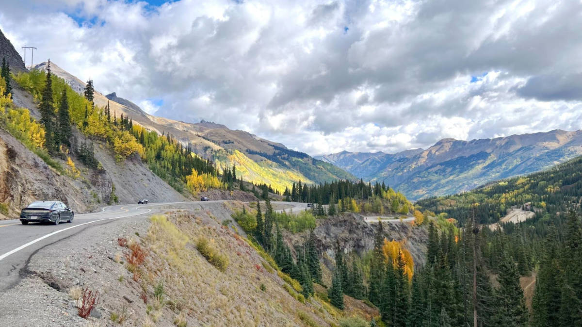
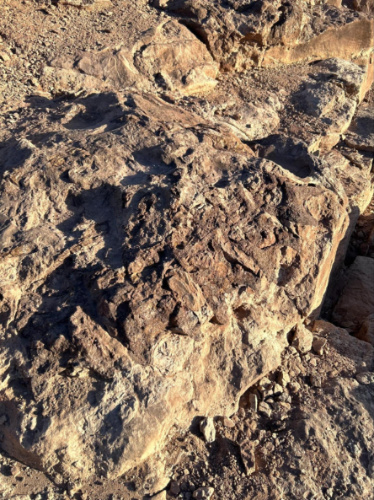
Million Dollar Highway
Discover history, hot springs, and breathtaking views between Silverton and Ouray.
📍 Google Maps Route | 🛣️ End-to-End Length: 23 miles (45 minutes driving) | 🗺️ Highlights: Ouray, Ironton Townsite, Ophir Pass, Silverton
The Million Dollar Highway is the most iconic section of the San Juan Skyway in southwest Colorado. This 23-mile route connects Silverton to Ouray, which is home to via ferrata routes, winter ice climbing, and some of the state’s best hot springs.
Meanwhile, activities in Silverton include backcountry skiing, fascinating gold mine tours, and the famous Durango & Silverton Narrow Gauge Railroad. Trust me, these destinations are worth the nerve-wracking drive.
With hairpin turns and lacking guardrails, many regard the Million Dollar Highway as one of the most dangerous roads in the country. Given this reputation, I was feeling a bit nervous before my solo trip this past autumn. But honestly, it wasn’t that bad!
If you’re nervous, though, I recommend driving the route from north to south to be on the inside lane through the most exposed section near Ouray.
Trail Ridge Road
A scenic drive through Rocky Mountain National Park that connects Estes Park to Grand Lake.
📍 Google Maps Route (seasonal) | 🛣️ End-to-End Length: 47 miles (2 hours driving) | 🗺️ Highlights: Estes Park, Alpine Visitor Center, Holzwarth Historic Site, Grand Lake
Trail Ridge Road is the highest continuously paved road in the country. Much of this seasonal route travels above treeline and through tundra. Admire views of wildflower meadows, dramatic peaks, and local wildlife like elk, marmots, and pika.
Estes Park is on the eastern side of the route and Grand Lake is to the west. Rocky Mountain National Park lies between these two mountain towns, and the road provides access to some of the park’s most iconic hikes. I highly recommend the Tundra Communities Trail for a good look at this unique alpine environment.
👉 Pro Tip: Note that Trail Ridge Road is only accessible from May through October and a National Parks Pass is required.
Trail of the Ancients
Experience the fascinating history of the ancestral Puebloan people on this southwest Colorado road trip.
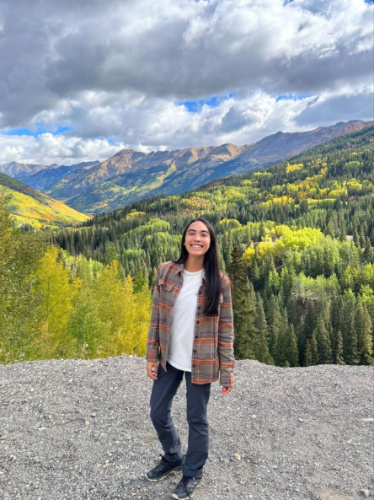
Disclosure: These images were taken on a complimentary media experience.
📍 Google Maps Route | 🛣️ End-to-End Length: 97 miles (2 hours driving) | 🗺️ Highlights: Mesa Verde National Park, Ute Mountain Tribal Park, Canyons of the Ancients, Four Corners
Trail of the Ancients is full of archaeological sites and accessible year-round. The northern part of this route features Hovenweep and Canyons of the Ancients national monuments. These areas offer insight into the culture of the ancestral Puebloans that once inhabited the region.
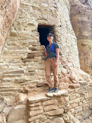
Head to Mesa Verde National Park next, the only UNESCO World Heritage Site in Colorado. Solo visitors can see many features like petroglyphs, kivas, and pit houses. However, guided tours allow entry into the park’s most iconic sites. This includes Cliff Palace, the largest cliff dwelling on the continent.
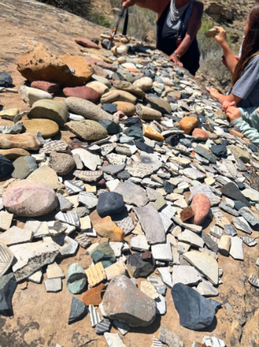
The southern portion of this driving tour features my personal favorite stop: Ute Mountain Tribal Park. This destination is only accessible with an Indigenous guide during spring through fall. Plan accordingly and be treated to an intimate experience that feels like stepping back a millenia. Here, countless ancient pottery shards lie in the sand beneath remote cliff dwellings.
Gold Belt Tour
See fossils in Florissant, mining tunnels at a former boomtown, and more historic sites

📍 Google Maps Route | 🛣️ End-to-End Length: 138 miles (4 hours 45 minutes driving) | 🗺️ Highlights: Florissant Fossil Beds Nat’l Monument, Cripple Creek, Royal Gorge Bridge
⚠️ Closure Notice: While most of this route is open, Phantom Canyon Road south of Victor is closed through December 27, 2025 for bridge repairs.
This scenic byway was named after 19th century gold prospectors, but others inhabited this region long before. The Gold Belt Tour begins at Florissant Fossil Beds National Monument. Here, fossils and petrified redwood stumps date as far back as 34 million years.
Further south lies Cripple Creek, where gold was first discovered in the Pikes Peak region. The mining town was once regarded as “the world’s greatest gold camp” and celebrated for its incredible productivity.
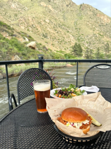
Cañon City is the next popular attraction. It’s famed for the Royal Gorge Route Railroad, where you can board one of the most scenic train tours in Colorado. Take a ride and enjoy views of the Arkansas River flowing through the impressive canyon. I also recommend visiting the Royal Gorge Bridge for an elevated view, as well as thrilling amusement park rides.
West Elk Loop
A Colorado road trip through must-see mountain towns and photo-worthy attractions.
📍 Google Maps Route | 🛣️ End-to-End Length: 205 miles (6 hours driving) | 🗺️ Highlights: Crystal Mill, Black Canyon of the Gunnison, Crested Butte, Paonia
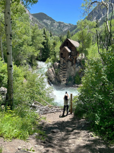
West Elk Loop passes through some of the best mountain towns in Colorado. Begin in Carbondale, then head south and detour to Marble, home to the famous Crystal Mill. It’s worth seeing but here’s my advice: Rent an ATV, as the rocky 9-mile route to this site is heavily trafficked (and not the most fun to hike with exhaust fumes in your face). Thank me later.
Next, cut west to Paonia. In the summer and fall, be sure to stop at Big B’s Orchard to pick your own peaches and cherries. The local wineries, especially Black Bridge, are also worth a stop.
Continuing on, you’ll reach the north rim of Black Canyon of the Gunnison National Park. This side of the canyon is far less popular than the south rim, yet offers equally spectacular views. Stay the night at one of its first-come, first-serve campsites and admire the stars at this International Dark Sky Park.
Finally, make your way to Crested Butte, the wildflower capital of Colorado. Experience these abundant summer blooms along the Snodgrass Trail and Walrod Loop, among many others. Mountain biking is also a must when visiting.
👉 Pro Tip: Note that the northeast portion of the loop between Crested Butte and Somerset is closed during the winter. Need a vehicle? Book through our preferred partner, Discover Cars.
Los Caminos Antiguos
Explore the San Luis Valley and its historic sites on this scenic drive

📍 Google Maps Route | 🛣️ End-to-End Length: 150 miles (2 hours 45 minutes driving) | 🗺️ Highlights: Great Sand Dunes National Park, San Luis, Cumbres & Toltec Scenic Railroad
Los Caminos Antiguos takes drivers through the scenic San Luis Valley. Start in Alamosa, then head east to Great Sand Dunes National Park. During early summer snowmelt, a seasonal creek runs at the base of the dunes and creates the coolest mountain beach. This park is also home to the tallest dune in North America.
I’ve hiked to the 8,617-foot summit of Star Dune and trust me, it is a serious undertaking but absolutely worth it. Far away from other hikers, the silence on this hike is loud. The only thing that cuts through the quiet is a low, cello-like hum of the sand as it rolls hundreds of feet downhill, pushed by your steps along the ridgeline. It’s pure magic.
Other attractions on this drive include San Luis, the first town in Colorado, and the state’s oldest church. If visiting from May through October, don’t miss riding the Cumbres & Toltec Scenic Railroad. This underrated train tour criss-crosses the Colorado-New Mexico border 11 times and the views are astounding.
📚 Related Reading: Major retailers are far and few between in this section of the state. Don’t forget your camera, hiking boots, and other essentials by following our Colorado packing list!
Cache la Poudre – North Park
Wildlife is abundant on this road trip along the state’s only designated Wild and Scenic River.
Disclosure: This image was taken on a complimentary media experience.
📍 Google Maps Route | 🛣️ End-to-End Length: 99 miles (2 hours 15 minutes driving) | 🗺️ Highlights: Fort Collins, Poudre Canyon, Rawah Wilderness Area
The Cache la Poudre is the state’s sole designated Wild and Scenic River, and its namesake byway is an absolute stunner. The journey begins in the college town of Fort Collins. Head west through the Roosevelt National Forest, stopping frequently to take in the sights.
I spent three days in the Poudre Canyon and it was one of my all-time favorite experiences. Don’t miss glamping at Riverside Colorado, a concert at the Mishawaka (or at least a stop for a meal), and the abundance of outdoor activities.
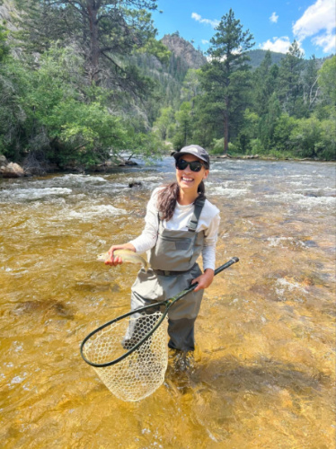
While many choose to go rafting or kayaking on the Poudre, I went fly fishing and have never been more lucky. Nine cutthroat and rainbow trout practically swam into my net! Not to mention, I saw a black bear while out on a hike and it made my entire summer. Bighorn sheep, elk, moose and more critters also call this canyon home.
Independence Pass
A breathtaking mountain pass that connects two of Colorado’s most charming towns.
📍 Google Maps Route (seasonal) | 🛣️ End-to-End Length: 44 miles (1 hour driving) | 🗺️ Highlights: Twin Lakes, Mount Elbert, Independence Ghost Town, Grottos Trail, Aspen
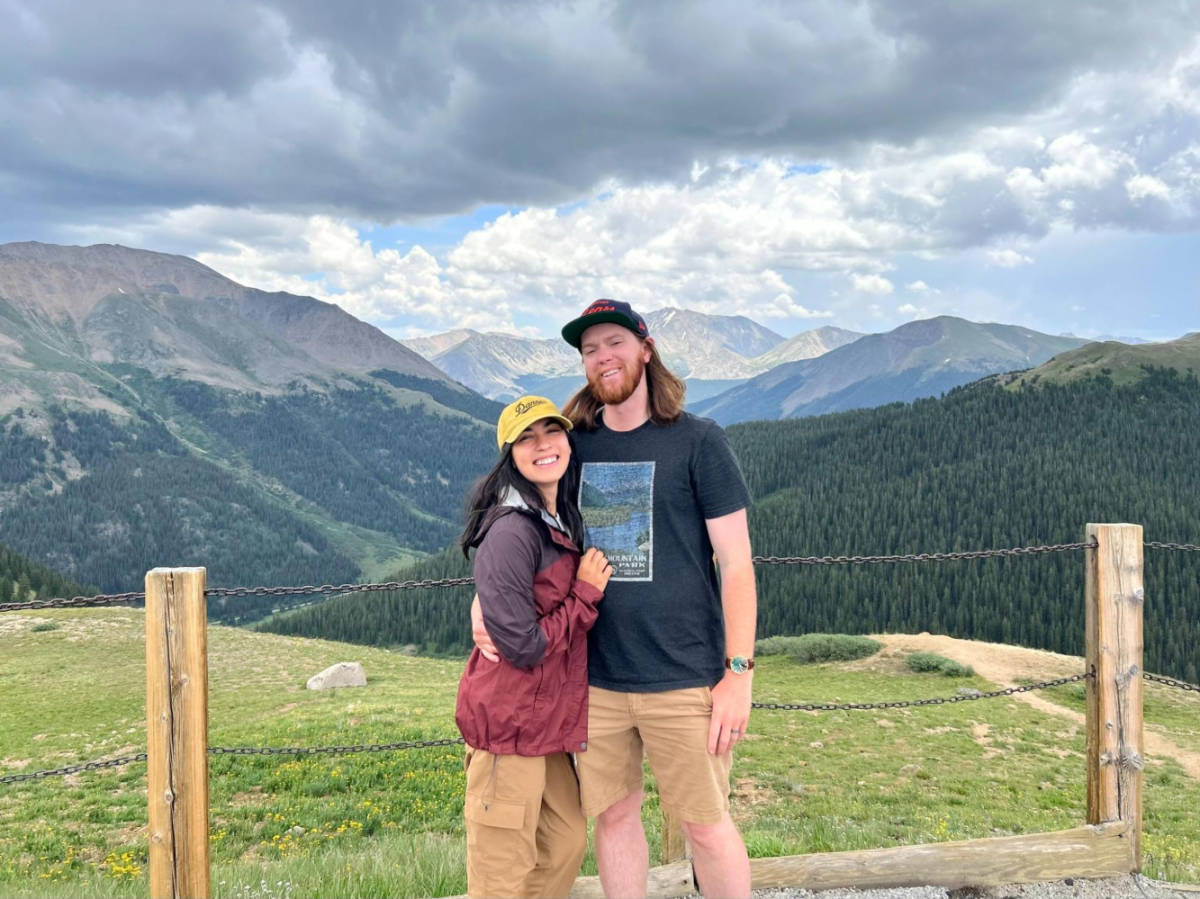
Generally open from June through October, Independence Pass is the highest paved highway in the state. It climbs to 12,095 feet at the crest of the Continental Divide and the entire journey is breathtaking.
Start at Twin Lakes and spend the morning paddleboarding, kayaking, or fishing on the water. Alternatively, hike among aspens and wildflowers on the trail to Lily Pond Lake. I loved this trek beneath Mount Elbert, the tallest of Colorado’s 14ers.
Then begin your drive through the White River National Forest. Plan to stop at Independence, one of the state’s most fascinating ghost towns. With its unique rock formations, the Grottos Trail is another great spot to stretch your legs before descending into Colorado’s most luxurious destination. Of all the activities in Aspen, don’t miss a trip to Maroon Bells.
Dinosaur Diamond
Prehistoric and Indigenous artifacts appear on this northwest Colorado drive.
📍 Google Maps Route | 🛣️ End-to-End Length: 149 miles (3 hours 15 minutes driving) | 🗺️ Highlights: Grand Junction, Fruita, Colorado National Monument, Dinosaur National Monument
The Dinosaur Diamond Scenic and Historic Byway highlights various points throughout history. The route begins in Grand Junction, where visitors can view incredible red rock canyons at Colorado National Monument. Rim Rock Drive allows you to see the park’s best sights.
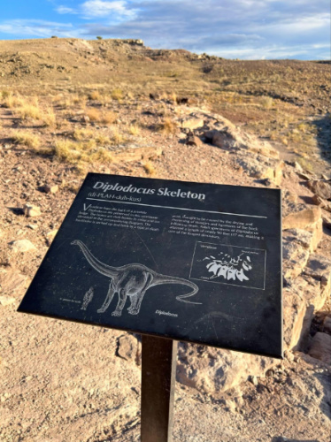
Then, head west to where Fruitadens were first discovered. Learn about the continent’s smallest known dinosaur at the Dinosaur Journey Museum and enjoy a hike at Dinosaur Hill. Further west is, in my opinion, one of the coolest Colorado hikes. The Trail Through Time features many unexcavated dinosaur bones — it’s like a free outdoor museum.
Now, continue north into Canyon Pintado to see petroglyphs left by the Fremont people more than a millennia ago. The road trip ends with Dinosaur National Monument which straddles the Colorado-Utah border. See an estimated 1,500 fossils embedded into the Wall of Bones, imprints of ancient sea creatures, and more geological wonders.
***
No matter which road trip you choose, you’re sure to discover plenty to see and do in Colorado. Leave me a comment if you have any questions and safe travels!
Is the Peak to Peak Scenic Byway open in winter?
Hi, Tom! Yes, the Peak to Peak Scenic Byway is open year-round. However, note that you may need a capable vehicle in the winter months. When conditions require, the Colorado Department of Transportation may implement traction laws, so you’d need AWD/4WD or tire chains. I hope this helps. The drive really is stunning!